Background
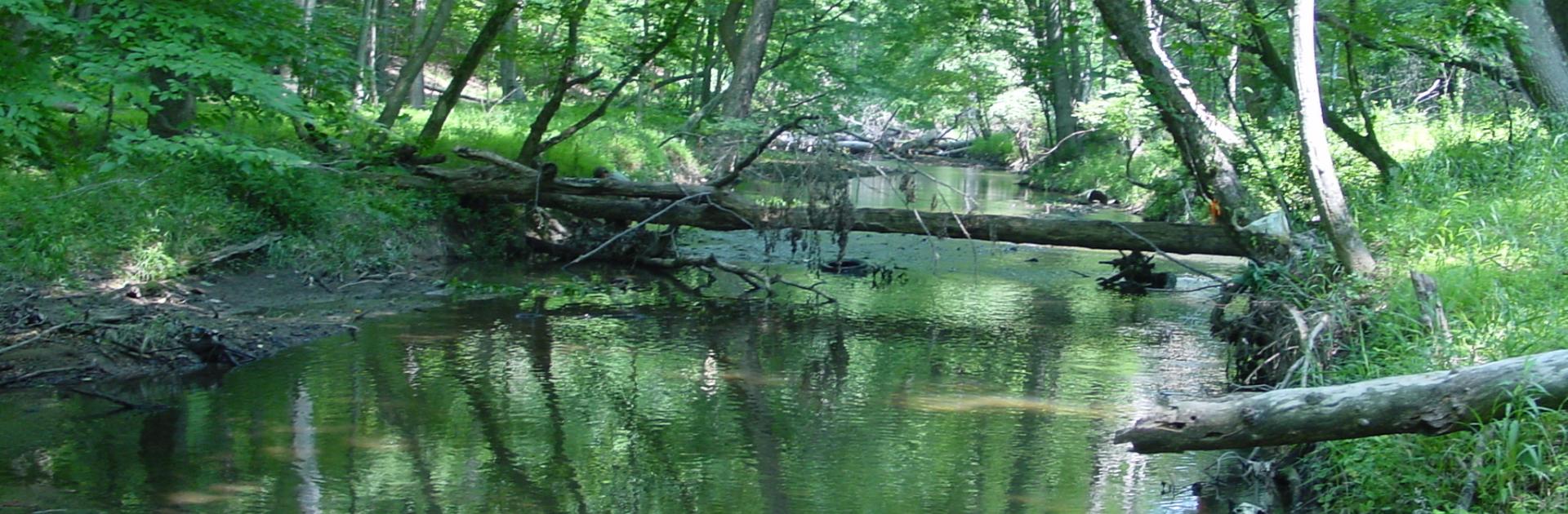
In Maryland, freshwater streams integrate the impacts of urbanization, agriculture, and deforestation within watersheds and transmit these disturbances as runoff, heat, and sediment to the Chesapeake Bay. Because anthropogenic disturbances alter stream community composition and often reduce biodiversity, biotic inventories of stream communities routinely are used to inform resource management and to assess the structure and function of stream ecosystems.
Considering the expense of field sampling, the coverage of biotic inventories typically is sparse relative to the area of management concern. Conservation plans therefore must often rely on either coarse extrapolation of biological attributes to watersheds or on some other, usually environment-based, stream classification scheme based on broad-scale environmental variables thought to be functionally related to, or correlated with, biological variation. A reliance on broad-scale environmental drivers comes at the exclusion of reach-scale local factors and can obscure fine-scale attributes of stream networks that support unique biological assemblages. In addition, stream classifications rarely consider the landscape context of streams and in particular, the role of stream connectivity in determining community composition.
In this project, we are combining novel statistical techniques for modeling the composition of biological communities with methodological advances in landscape ecology that facilitate the development of environmental parameters that describe both local and landscape-scale characteristics of individual stream reaches. We will use these methods to quantify and map biological composition of Maryland streams at high spatial resolution.
Objectives & Methods
The main objective of our research is to develop a stream classification model that best discriminates stream reaches with similar biological characteristics and which can be used to inform the protection and restoration of streams in the context of global change. We will use our models to pursue additional analyses to consider the role of connectivity in determining community composition and to estimate the proportion of species lost as a result stream burial (the practice of directing streams into culverts, pipes, and concrete-lined ditches during urbanization). Specifically, we will investigate 3 key questions:
- What is the spatial distribution of aquatic community types in Maryland and which might be prioritized for protection or restoration?
- What is the relative importance of connectivity and environment in determining community composition and how does this vary by fish and macroinvertebrates?
- How has stream burial impacted stream biodiversity?
Task 4: Estimate the impacts of stream burial on stream biota.
Using output from our new statistical models and maps of stream burial through time, we will estimate the proportion of stream biodiversity lost as a result of urbanization since 1975.
Task 1: Develop environmental and stream burial datasets
Our goal is to assemble novel spatial continuous representations of land cover, topographic, and parameters derived from ongoing work at AL on stream burial at a range of scales for modeling stream community composition. At every sampling location from the Maryland Biological Stream Survey (MBSS) and for every 10-meter reach of stream habitat, we will develop a comprehensive set of topographic, land cover, stream burial, and environmental variables that acknowledge both local- and landscape-scale conrols on aquatic species composition as well as the hierarchical nature of stream networks.
Task 2: Estimate connectivity of stream reaches
Using new methods to quantify connectivity of stream reaches, we will assess the differential importance of connectivity and environment in determining community composition of fish and macroinvertebrates.
Task 3: Develop models of aquatic community composition
We will develop a biologically-optimized environmental classification of Maryland streams as a function of both environment and connectivity using novel statistical approaches. These methods will allow us to predict composition of fish and macroinvertebrates as a function of our novel environmental predictors and connectivity measures. The output will be used to map fish and macroinvertebrate community types and to quantify group similarity.
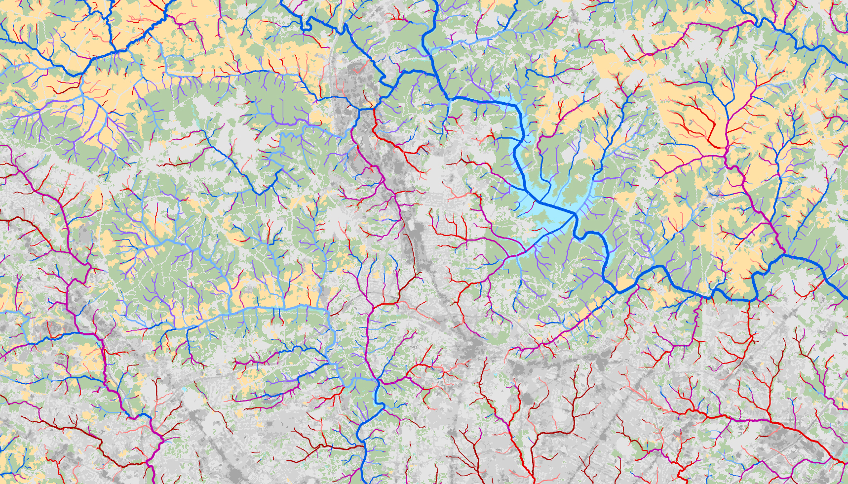
The map below displays stream classification using preliminary models and showing the spatial distribution of 7 groups of stream benthic macroinvertebrate communities in the Gunpowder-Patapsco watershed with surrounding land cover. Similarity of colors of stream reaches roughly approximate similarity of biota.
Anticipated Benefits
In 2010, the Environmental Protection Agency established a Total Maximum Daily Load (TMDL) for the Chesapeake Bay, meeting the targets of which will require significant improvements to water quality throughout the Bay's watershed, most notably the restoration and protection of streams. At the same time, the impacts of urbanization and climate change on streams are expected to increase. Our combination of new spatial analysis techniques, maps of stream burial, and advanced statistical modeling will produce three integrated products critical for prioritizing the protection and restoration of streams in the context of global change.